Feeds:
Posts
Comments

Archive for the ‘Hikes’ Category

Alex and I have made two trips to the Believe in Books Literacy Foundations trail network over the last month. It is an excellent area to explore if you only have an hour or two, just 10 minutes north of North Conway Village.

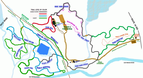
100 Acre Wood Trail System

100 Acre Wood Trail System

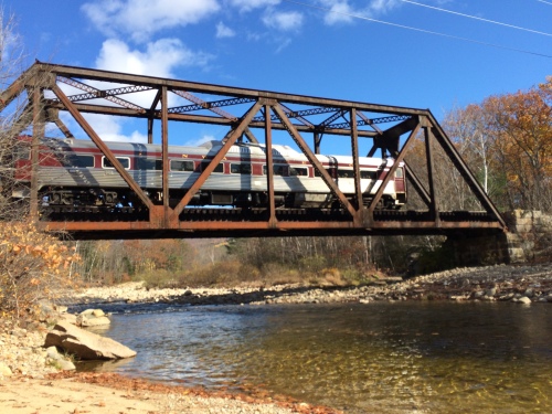
On our first excursion with our friends Kaelan & Heather we wandered around without referring to the map and basically took “Polar Path” to “Railroad Alley” and “Winnie’s Wandering”, right down to a beautiful little swimming hole on the East Branch River. The highlight for the boys was seeing a train from the Conway Scenic Railroad cross the trestle.

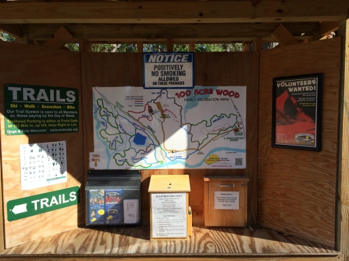
Don't forget to grab a map!

Don’t forget to grab a map!

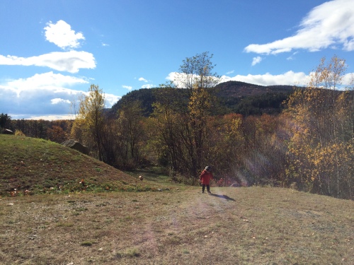
Views of Cathedral Ledge in the distance

Views of Cathedral Ledge in the distance

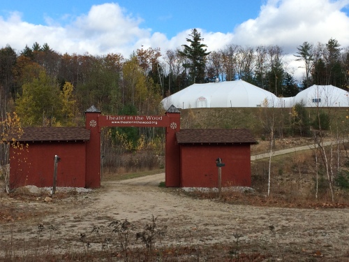
This is where the "North Pole" is for the famed Polar Express!

This is where the “North Pole” is for the famed Polar Express!

A small reservoir

A small reservoir

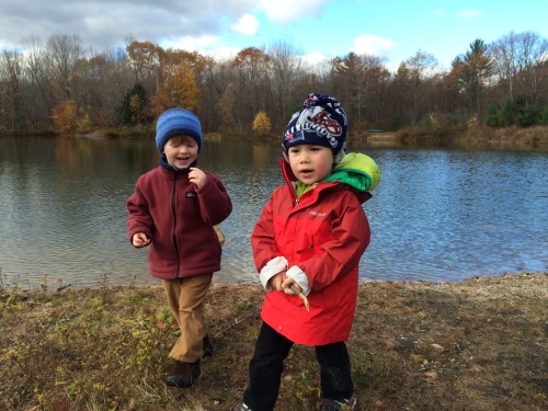
Skipping rocks and exploring

Skipping rocks and exploring

Well signed trails

Well signed trails

Choo Choo

Choo Choo

On our way out another hiker told us of the “Storybook Trail”, and while we were out of time for this day I brought Alex back a week later so we could check it out. This short half mile trail has stations every 100 feet or so with the next page of a story. It makes for a fun interactive hike!

This week's book "Dragons Love Tacos"

This week’s book “Dragons Love Tacos”

This place is another great family destination in Mount Washington Valley. You should check it out!

From their website:

100 ACRE WOOD TRAIL SYSTEM
Hours: Generally 9am-4pm • Trail passes are $3 per car load for the day, An annual pass is $50 and can be purchased at the Foundation office. (The 100 Acre Wood Trail System is open when the entrance gate is open)
1/2 Mile Storybook Trail:
“Dragons Love Tacos” by Adam Rubin
TRAIL CONDITIONS: Perfect Fall Conditions!
COMMENTS: Walk, bike or run. Dogs are Welcome on a leash but please clean up after them!

Read Full Post »

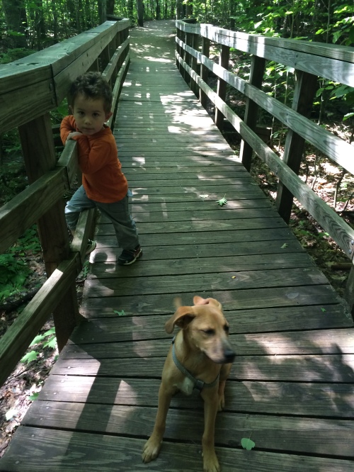
We pulled into the parking lot a few minutes after 10AM. There were still plenty of parking spots open but as I glanced at the growing flipflop crowd already coating themselves in DEET (it was 64 degrees, breezy, with no bugs) I wondered why I was bringing us to such a heavily used trail for our first hike with our new puppy, Echo. I carried an empty kid carrier and with Echo on a leash and Alex by my side we left the parking lot and dipped into the woods.

This would be a bit of a training hike for Echo. Just a few minutes up the trail I was able to let Echo off leash and start “releasing” him and calling him back with my stash of smoked turkey treats. Alex already had the hand signals down to accompany “sit”, “stay”, “go play”, and enjoyed helping Echo learn.

Almost to the falls

Almost to the falls

As we approached the falls I put Echo back on leash due to the amount of people and a few other leashed dogs in the area. We made our way over to a sunny spot on the rocks to watch the swollen water from last nights epic storms.

Snack & Water Break

Snack & Water Break

When I mentioned leaving so we could meet up with Mommy for lunch Alex was adamant we do some exploring. I brought us a bit further up the trail away from the crowds so I could let Echo off his leash. Alex wanted to go off trail to explore a muddy little stream. My first reaction was to reel him in so he wouldn’t get muddy from the assured trips and face plants off trail travel would bring this 34 month old, but then I started thinking about this excellent piece by Emma Marris, “Let Kids Run Free in the Woods”, which I found through the Expect Adventure blog.

I wanted Alex to love hiking. If I always keep him from running, scrambling, exploring, and jumping in every puddle would he really want to keep doing it as he gets older? So I let Alex off the proverbial leash and off he went into the woods.

Bushwacking

Bushwacking

I was proud to see face height vegetation didn’t creep him out like it did this Spring when we were hiking at Tin Mountain Conservation Center. He scrambled over mossy boulders, found some ankle deep mud to jump in, and explored for almost 30 minutes. At one point he told me to stop following him, so I pulled back to about 40 feet from him. He wandered in circles for another 10 minutes humming and playing. This independent nature play was so great to watch. After almost an hour he looked up and when he didn’t see me right away he said “Daddy”?

“Yes, Alex?” as I stepped into view.

“I like hiking” he said.

“Me too, buddy. Want to hike back to the car so we can have some lunch with Mommy?”

This tree is BIG daddy!

This tree is BIG daddy!

Alex decided it would be fun to run back, and he pretty much ran the entire .6 miles back to the car. He would run for a minute or two, take a quick breather, then run again. He especially loved when Echo would run right next to him. We passed quite a few families with kids on their way in. I saw a few parents who were constantly telling their kids (much older than Alex) to stop running, stay on the trail, slow down, put that stick down… I could see some of these kids look at Alex with some envy as he blasted down the trail laughing and giggling all the way back to the car.

It feels good to be off leash.

Read Full Post »

Like most of nature Adventure With Alex slumbered through most of the winter. That isn’t due to a lack of wanting to get Alex out in the snow, but my guiding schedule in the winter isn’t too conductive to finding time to take Alex hiking (or blog about it). We did get a few ski days in and I documented his very first ski day here. While it has officially been Spring for a few weeks the 1.5 feet of snow in my yard could convince you otherwise. In search of some snow free trails I decided to head an hour south and around Lake Winnipesaukee to climb the popular Mt. Major.

At just under 1,800 feet and just less than 3 miles round trip this would be a perfect break-in to see how much heavier my now 2 and a half year-old was. We had to run a few errands in town so didn’t arrive at the trailhead in Alton, NH until noon. Alex had napped a bit on the drive and seemed excited to go hiking again, but within just a few minutes on the trail he started in with “Wanna go home Daddy”. For a moment I thought that might be best given the trail was anything but snow free. It was actually water-ice for the most part, and I was without any form of traction. However it was softening quickly in the 50-60 degree sunny day, and my beloved Five Ten Camp Four approach shoes were actually getting pretty decent traction. I distracted Alex by creating a find the next blaze game, which he took to quickly and loved pointing out the next blue blaze he could find on each tree.

Hunting blue blazes

Hunting blue blazes

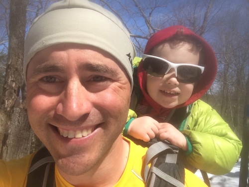
It was quite bright out, and I had been smart enough to bring Alex’s sunglasses when we left the house and dumb enough to forget them in the car, so I soon passed my sunglasses back to an appreciative toddler following me closely up the mountain.

Sunglasses a bit oversized, but that’s the style right?

Sunglasses a bit oversized, but that’s the style right?

We took the direct route up to the summit, and while not steep by my standards I realized I usually like trekking poles with Alex on my back. I’ll also be honest and admit I forgot a few other items on this 1st toddler hike I would recommend to never go with out, mainly my first aid kit and headlamp. Luckily neither would be needed, but I noticed there were sections of the trail with no cell coverage… my work issued PLB (Personal Locator Beacon, SPOT  Gen 3)  was also sitting safely at home… well, reflections like this make us more prepared for the next hike!

We reached the summit in just over an hour, having only passed a young couple just off the trail right before we hit the summit.

Lake Winnipesaukee still frozen with a white Mount Washington in the clear distance

Lake Winnipesaukee still frozen with a white Mount Washington in the clear distance

We grabbed some shelter from the light winds in the old stone foundation that used to house a shelter for hikers and snacked and explored.

Alex loves his organic fruit/veggie push pouches

Alex loves his organic fruit/veggie push pouches

Osprey Poco Premium Child Carrier Season 3!

Osprey Poco Premium Child Carrier Season 3!

iPhone 5s Panorama

iPhone 5s Panorama

Bluebird

Bluebird

After about 15 minutes we started back down, Alex under his own power holding my hand. He loved hopping down the rocky slabs and sloshing though some spring corn snow. 10 minutes down the trail we decided it was time for him to hop back aboard and we made our way down the Boulder Trail back to the car.  Much of the upper part of this trail was south facing and snow free, but as we dropped and turned east then north the trail was a running stream bed of melt off. It wasn’t too hard keeping the feet relatively dry by linking exposed roots and rocks and we reached the parking lot just 2 hours and 2o minutes from our starting time.

Mt Major, Our Route

Mt Major, Our Route

I’m very excited for this Spring/Summer/Fall season with my toddler son. The fact that he can communicate desires like food & water, warmer or colder, will make hiking so much easier. I’m also hoping to build up a network of other rock climbing dads & moms who have toddlers so we can spend more time at the crag. Finally, I am most excited to be able to represent a couple great companies that have supported me with gear.

Friendly Foot and Piggyback Rider have provided me with some samples of their products and I am really stoked on being an ambassador for them. I extensively tested Friendly Foot throughout the winter in my backcountry ski boots and ice climbing boots, and the results have been very positive. Alex is just reaching the age to be able to use the innovative Piggyback Rider so expect a detailed review on that early this season once we have some miles “on the bar”.

So the winter slumber is over. It is pretty easy to spend time outside with a toddler now that the mercury is above freezing and I have a bit more spare time to plan adventurers. I hope you enjoyed this trip report and follow us this season, I’m sure it will be a busy one! See you in the mountains!

Read Full Post »

Alex and I took advantage of the fine weather today to stretch our legs on the Eastern Slope Inn‘s Nature Trails. Right in downtown North Conway this short fitness trail (River Walk Trail) starts just behind the resort and runs between  the beautiful North Conway Country Club and River Rd, ending at the Saco River.

Eastern Slope Inn Nature Trails

Eastern Slope Inn Nature Trails

Despite being a very short mellow walk this trip marks the first hike that I didn’t bring the kid carrier or stroller. Alex would be 100% self propelled from start to finish!

Off to a running start

Off to a running start

Right after leaving the parking lot Alex spotted his first moose! Human statues tend to freak him out a bit so I was surprised with how cool has was with this monster.

The Moose!

The Moose!

Educational

Educational

This nature trail doubles as a fitness trail, so every 200 feet or so we came across a fitness station. Alex decided at each one what he would do. On this one meant for sit-ups he would do 1 push up on each of the 4 bars. It was quite comical when an older couple walked by and saw Alex “working out”.

Alex doing push-ups

Alex doing push-ups

After reaching the river we started back and decided to explore the golf course a bit. I don’t think they are open this late in the season, and there were no signs warning us of trespassing so I assumed it was ok.

Plenty of room to run!

Plenty of room to run!

Posing with Whitehorse Ledge in the background

Posing with Whitehorse Ledge in the background

Sandbox Daddy!

Sandbox Daddy!

Shadow fun

Shadow fun

Well that much fun had us ready for lunch so we headed over to one of our favorite lunch sports, The Chef’s Market. Michelle walked over from work to meet us and we caught up with owners Byrant and Patti who couldn’t believe how quickly Alex has reached toddler-hood. After a scrumptious lunch we headed for home, and Alex slept for a solid 3 hours after completing his first self-propelled hike!

Tired boy after lunch

Tired boy after lunch

Being surrounded by hundreds of miles of White Mountain National Forest trails can make me overlook these small nature walk adventures that are so simple and quick to pull off! Not everything has to be a 4000 footer adventure (I’m learning). I expect now that Alex can handle walking almost a full mile on flat terrain we’ll be doing a lot more of these soon!

Do you have a short nature walk in your area you love? If so let us know in a comment below!

Read Full Post »

I’ll admit it. I have a competitive streak when it comes to hiking. When I look at an estimated hiking time in a book I quickly think about how much I can “beat” that time. Hiking solo I could often cut the book time in half. Hiking with Alex on my back has adjusted that down to about 2/3 of “book time”. I like to move quickly through the mountains and I don’t feel I am missing the vistas or not smelling the flowers… I feel “efficient”.

Today’s Forecast: 72 degrees and “abundant sunshine”, light winds, low humidity, perfect. Michelle had been wanting to climb Chocorua (elev. 3,500ft) for a while. That’s understandable as we can see it from our neighbor-hood and it is the most photographed mountain in New Hampshire; a recent addition to the backs of NH State Quarters.

Late last night we planned to take the Champney Falls trail to summit, a heavily traveled route from the Kancamagus Highway that rises 2,250ft in 3.8 miles (using a bit of the Piper trail at the top). Everything was in place for a fun family hike.

Trailhead shot

Trailhead shot

Book time for this ascent was 3 hours flat. I figured we could do it in 2 hours, 20 minutes. The first mile of the trail was a gentle ascent and we passed multiple parties.  I’d be lying if I didn’t say I love passing parties with small backpacks (if a backpack at all) with Alex on my back and when I do so a small smile creeps across my mouth. That smirk gets full blown when just before I go out of earshot up the trail I hear someone I passed exclaim “wow!” As any racer knows passing people makes you feel stronger. However this is a part of my ego that needs to get checked when hiking with the whole family.

As we hit the steeper switchbacks an hour into the hike Michelle mentions we need to slow the pace, and I oblige. I can cruise with the 45 pound load on my back on flat and gentle ups, but when it gets steep I welcome reining in the pace. All seems well when we reach out first nice view, an hour and 45 minutes into our hike.

A good spot for a break

A good spot for a break, if one is smart.

Here I make a fairly big mistake. When I mention to Michelle how much further we have she suggests a break, her legs are feeling fatigued and a bit shaky. I justify we are “super close” to the summit and we should push on. Ego. We’re on par to crush book time. Up we go.

20 minutes from the top

20 minutes from the top

It's just over there!

It’s just over there!

A crowded summit

A crowded summit

5 minutes from the top

5 minutes from the top

We scramble up the last 100 feet. There are some third and possible 4th class moves here, and the exposure + crowds of less than sure-footed hikers has got Michelle a bit anxious. I can see it in her face. This is not fun for her. I’m somewhat surprised at the summit marker when I turn to her and she sends me a high-five. She’s not stopping up here on the exposed crowded summit though, and wants to retreat down to the col below before stopping for our first break of the day.

Total ascent time: 2 hours, 15 minutes. While we crushed the guidebook time we would pay for it later. We stopped on a nice flat sandy spot with some excellent blueberry bushes. Alex was ecstatic to learn that “boo-berries” could be plucked and eaten on the spot. It was an excellent break.

Comfy late lunch spot

Comfy late lunch spot

After a substantial break (30 minutes), we loaded back up and started out descent at 2:45. Despite the break, we were feeling the fatigue of the non-stop ascent with zero breaks that I had coaxed us on. Not 20 minutes down the trail Michelle rolled her ankle. Still being weight bearing, we continued albeit more slowly. We had stopped talking. Michelle rolled her ankle again. We slowed down again. Carefully making our way down it took 1.5 hours to get back to the car. It was a LONG ninety minutes. It wasn’t fun. I knew I had pushed us too hard on the climb up and Michelle probably would have not rolled her ankle if our pace had been more “normal”. Had we taken a 10 minute break at that first view point the whole day could have been a success. I wouldn’t hike that fast with clients up Mount Washington because I know what wearing someone out early leads to. You hit “the wall”. You crash. You risk injury. Man is hindsight 20-20.

photo (3)

I won’t bore the reader with the apologies I have made to my wife, but I’ll share a promise I made. Whole family hikes should enjoy trails according to “book time”, not trying to “crush it”. Success is not measured in how fast you climb something, but how well you climb something, and today I did not climb Chocorua well.

Read Full Post »

Today was Alex’s biggest adventure to date! Today, at 22 months of age, Alex summited Mount Washington, the highest peak in the Northeast.

It started during last weekends Mount Washington Observatory’s “Seek The Peak” event. Last year Alex was only 10 months old during the annual fundraiser, billed as “The Nation’s Premier Hiking Event”, but I wasn’t ready to bring him above tree-line. I had planned a long solo hike of the Great Gulf and at the last minute discovered I was without a babysitter, so instead we enjoyed a short loop hike below tree-line on the low shoulders of Mount Washington. That trip report can be found here.

This year, after having enjoyed close to 200 miles with Alex on the trail, I felt summitting with Alex was possible if weather conditions were favorable. Plans were made for the scheduled Saturday hike with friends & family. Then, due to forecasted strong winds, large hail, and heavy rain, the MWOBS encouraged hikers to reschedule their summit bid for Sunday. So this past Sunday we started up the Ammonoosuc Ravine Trail with our friend Lara and some visiting family from MA and NJ. Due to a variety of reasons we intended to only take Alex so far, and turned around after Gem Pool. It was a bittersweet day as I later realized continuing on would have been feasible. We decided not to dwell on the hiking day that could of been, and instead looked forward to the next good weather window to which we could attempt a climb. Luckily, we didn’t have to wait long as today’s forecast was stellar!

We returned to the Ammonoosuc Ravine Trail, the shortest trail from the west side of Mount Washington. Leaving the trail-head we made quick time and in just 40 minutes reached “Gem Pool”, where we took a quick 10 minute break for snacks.

Like father like son

Like father like son

Mommy and Alex enjoying some time out of the backpack

Mommy and Alex enjoying some time out of the backpack

Here, the climb really begin’s as stone steps lead up 1,500 feet in elevation in one mile. After the steepest section views back to the east start to open up and multiple cascades and brook crossings make the trail more enjoyable.

One of many scenic falls

One of many scenic falls

Gettin' steepa'

Gettin’ steepa’

Quick break 20 minutes from Lakes In The Clouds
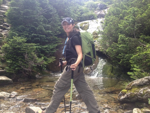
Quick break 20 minutes from Lakes In The Clouds

Feeling good

Feeling good

Wait... more steps?

Wait… more steps?

Whole family shot

Whole family shot, can you tell who is starting to get sleepy?

Within 5 minutes of reaching the AMC Lakes in the Clouds Hut I heard Alex start to snore… a bit more than 2 hours into the hike and right on schedule!

I eat, he sleeps

I eat, he sleeps

After another 10 minute break we jumped onto the Crawford Path, the oldest hiking trail in the country BTW, to continue our ascent. Of course we stopped for the obligatory lake shot, which will be gracing this blog header soon.

Classic

Classic

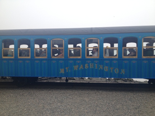
As we neared the summit we braced ourselves for the enigma of Mount Washington. It is an amazing and confusing place. One minute you are hiking up one of the most rugged mountains in the country, and moments later you are being gawked at by hundreds of visitors clad in flip-flops and cotton who ascended the mountain by automobile or train. Before anyone thinks I’m about to complain, let me make it clear I LOVE this aspect of Mount Washington. It is a treasure of NH, and the east in general, and I am happy those who can’t hike (or shouldn’t hike) are able to see some of the beauty and raw nature that has had such a profound impact on my life. While some of my die-hard mountain friends may despise the “circus” up there, I feel it has its place here… and for the most part… come winter… the mountain is all mine again…

But I’m getting off the focal point here. Now’s a good spot I think to share our timeline:

9:20 – Left the trail-head at the Marshfield Station.

10:00- Arrived Gem Pool (2.1mi, 950ft gain)

10:10- Left Gem Pool to ascend to Lakes in the Clouds Hut

11:40- Arrived Lakes in the Clouds Hut (1mi, 1550ft gain)

11:55- Left Lakes for Summit

12:50- Arrived Summit, got in line to take picture at summit (1.5mi, 1,300ft gain)

TOTAL: 4.6mi, 3,800ft climb

1:10- Took summit photo (see below)

1:25- boarded Cog

1:30- started descent via Cog

2:15- arrived Marshfield Station

The line to get a summit photo

The line to get a summit photo

Alex woke up minutes from the summit

Alex woke up minutes from the summit

Alex's 1st 4000 footer, and 6000 footer for that matter...

Alex’s 1st 4000 footer, and 6000 footer for that matter…

Some interesting statistics from our hike:

We spent 3 hours and 5 minutes actively hiking to the summit.

We spent 25 minutes “breaking” during 2 breaks, one at Gem Pool and one at Lakes Hut, for a total hike time of 3.5 hours. “Book” estimated time total is 4 hours 10 minutes, so we crushed that by 40 minutes.

Alex slept from just below Lakes to just before the summit (about 1 hour nap).

We spent 15 minutes in line to take out summit photo (no biggie).

Then, due to some serendipity, we were able to grab the last two seats on the Cog Railway train departing the summit right after our summit photo.
Ammonoosuc Ravine Trail 035

Ammonoosuc Ravine Trail 037

Ammonoosuc Ravine Trail 045

Alex LOVED the train ride down, but I need to make any readers aware of some potential issues relying on the train (or road) as a possible easy way off the mountain. First, it’s expensive. Like $45 per person one way. But financial cost is no where near as important as the other reasons to reconsider counting on the train for your descent. Priority is given to round-trip passengers, and most trains come up with a full boat, so you could be stuck for hours on the summit waiting for an open seat. 2nd, the train may cease service at any time due to inclement weather. 3rd, you may get into trouble trying to “push on” thinking the train (or auto-road) will safety get you down the mountain. Quite a few people have perished on the mountain pushing higher thinking of the illusion of nearby safety and the mirage that it is “just right over there”. Just last week a 30 year old from NY lost his life while hiking down a nearby mountain when he apparently succumbed to heat stroke.

DO NOT be lulled into relying on the summit facilities, Cog, or auto road, to provide any margin of safety during a climb of Mount Washington. If at any time in your hike you’re not confident that you could safely turn around and get back down under your own steam then turn around now! Pushing on gets people killed… If we didn’t get a seat on that departing train we had plenty of reserves, evidenced by our quick ascent time, to hike down the Jewell Trail to finish our day. Our only reason for using the train was Alex does not like to spend much more than 3 hours in the backpack. He would definitely get cranky during the descent. While I may be stressing this a bit strongly, I had multiple well intention-ed fathers ask me on the train how they could pull off such a great family hike, and it needs to be clear that everyone needs to Hike Safe, and be self-reliable in the White Mountains.

Ammonoosuc Ravine Trail 044

After getting back to Marshfield Station Alex enjoyed some time running around in the fields, picking flowers, and playing with a little German boy a year older than him.

Ammonoosuc Ravine Trail 046

Ammonoosuc Ravine Trail 047

This has been by far Alex’s greatest adventure to date, and I am thankful I was able to share it as a complete family. We are energized from this success to tick off what other White Mountain peaks we can this season with Alex before winter returns to the high peaks, so if you want to follow along, please follow the blog here or on our new Facebook page. Also “like” and “share” to your hearts content!

Happy trails!

Read Full Post »
Yesterday the whole family got out for a morning hike and our good friends and neighbor’s, the Ouellette’s, joined us. Alex was excited to have his little buddy Declan along for the ride, along with two canine companions, Rocky and Apollo. We hit the trail at about 10:30am. Two weeks ago Alex and I had explored some of the trails at Purity Spring Resort on the west side of Eaton Road, climbing up to the scenic Bald Ledge. Today we opted for some of the more mellow trails on the east side which would bring us through most of the NH Audubon Hoyt Wildlife Sanctuary. After crossing a small footbridge at the outlet of Purity Lake and close to the Purity Lake Dam we skirted the east side of the lake for a short distance before moving through some rich wetlands.

Some beautiful pine forest

Some beautiful pine forest

An inflatable rock climbing wall in the swimming area of the resort (guests only)

An inflatable rock climbing wall in the swimming area of the resort (guests only)

Cruzing

Cruzing

Not long after this shot we heard a rather large animal down a small drainage to our right. As much as Randy and I scanned we couldn’t spot it. My guess was we had startled a moose. This wetland area is perfect for them, and while they can make a racket when being roused from a comfy spot they can just as quickly move away as stealthy as a ninja. Ninja moose, LOL, I like it. Other than the small flying biting type of wildlife we didn’t see anything else except for occasional beaver dams.

Alex has mastered drinking from the CamelBak

Alex has mastered drinking from the CamelBak

About halfway around the loop

About halfway around the loop

Size-able Beaver Dam

Size-able Beaver Dam

Small footbridge near the end

Small footbridge near the end

Great company

Great company

The Route

The Route

It was a leisurely 90 minute 1.9 mile loop when all was said and done. We grabbed some shade at a picnic table near “The Mill” and let the little guys stretch their legs. Declan seemed to enjoy his first backpack ride and Alex made the whole loop without needing to get out of the pack. Lots of guests were cooling off in the private swimming area, but we were ready to head home for some lunch and a dip at our local beach. This family owned resort is a little gem and I still want to explore it more so expect to hear about it again at some point.

Web articles coming up this week:

Bugs & Infants: How to stay outside in the thickest of bug conditions

If you enjoyed please Follow & Share! (The “Follow” Link is back at the top right of the website)

Read Full Post »

Last Thursday Alex and I had a couple hours to hike and I decided to head south through Madison to Purity Springs Resort. I’d driven by this resort a few times and had heard they had some nice hiking trails so I was excited to finally check some of them out. Particularly, I wanted to check out Bald Ledge, a cool looking bluff I had seen from further south on Route 153.

Around 9:30 we stopped into the “Millbrook” front office where the receptionist provided us with a couple maps of the grounds. Seeing I was carrying Alex the suggestion was made for some of the shorter flatter hikes but we planned to tick off the longer climb in the area, Bald Ledge, about 3 miles roundtrip with about 800ft of climbing.

A hand drawn map of the trails

A hand drawn map of the trails

A nice watercolor of the grounds

A nice watercolor of the grounds

We took the Tower Trail, which was a gentle climb for the most part, and very well marked. Outside of a family friendly resort such as this one might find the amount of trail markings on such an obvious path a bit intrusive, with plastic arrow markers nailed to trees almost every 40 feet, but it didn’t impede on the geologic beauty of the area as we reached an interesting tower with restricted views to the southeast.

Plenty of signage on the lower trails

Plenty of signage on the lower trails

About 45 minutes into the hike we reached the Bill Sexton Shelter, which was perfect timing as Alex had been asking “eat?” for the last 10 minutes. We unloaded and took a nice 15 minute break to explore the rustic cabin, complete with wood stove and outdoor fire-ring, snack a little, and change a rare trail dirty diaper (2nd dirty diaper in about 175 trail miles).

Bill Sexton Shelter

Bill Sexton Shelter

A view towards Bald Ledge from the Bill Sexton Shelter

A view towards Bald Ledge from the Bill Sexton Shelter

We continued on towards Bald Ledge at a quicker clip now that the angle had lessoned and views south towards Ossipee Lake started to appear. Open slabs with plenty of blueberry bushes (not in season) allowed a great pace.

Open slabs near Bald Ledge

Open slabs near Bald Ledge

Mandatory self portraits

Mandatory self portraits

Soon after this shot as I neared the end of the Bald Ledge trail I heard small snores from behind my head as Alex succumbed to the fresh air and rhythm of being carried… I caught his water bottle as he released it but unfortunately lost his ball cap at some point without noticing… I need to look for an attachment to keep a fallen cap with us.

The view from the end of the trail was decent, and I could see the section of Rt 153 I had slowed down on to eyeball these ledges a few months ago. I retraced my steps back to the shelter, and back to a small side trail, the “Panther” trail according to the map, in order to get a small loop in on our return. Alex slept for about 40 minutes, and as we got close to the tower he awoke quite happy. We shared a couple versus of “The Bear Went Over the Mountain” before reaching the resort.

Our Route

Our Route

Almost 2 hours exactly round-trip, and just over 3 miles, with the 800 feet of climbing. We stopped back into the office to thank them for the maps and get some PR info. I’d like to revisit soon to explore the rest of their trail network and perhaps write a more substantial review of their resort. A quick stop over at their fitness center and pool was informative as Nancy gave me and Alex a short tour of  “The Mill” and a brief history of this 100+ year family resort which is currently run by a 5th generation owner! I’ll link back to that review here when it posts, but if you’re interested why not just follow the blog so you don’t miss it? My wife and want to check out their “Traditions” restaurant, and their outdoor summer lobster bakes, and I’ll definitely post that info up when it’s available.

In the meantime, if you’re looking for a family friendly resort for an active family with small kids, this place looks awesome. Please check them out at http://www.purityspring.com/.

Read Full Post »

Seeing a break from the recent rain appear we made for the 4.1 mile loop hike a few miles from our house. I hiked this trail counter-clockwise years ago before Alex, and made a couple rock climbing trips to the cliffs last Fall, so I decided to hit the loop with Alex clockwise today. We parked in the White Ledge Campground off Route 16 at about 10:20am. A small parking lot towards the back is signed for “picnicker’s and non-camper’s”. Alex seemed excited to be out and even hiked for himself a 100 yards before asking “up”.

Alex felt quite a bit heavier than he did a few weeks ago on our last hike, but it was probably the 100 oz of water I was toting that made the difference. He’s just over 25 lbs now, and the additional 15 pounds of pack-weight, gear & water, had me climbing at a snails pace for the first hour.

Here we go

Here we go

Slowly climbing up to White's Ledge

Slowly climbing up to White’s Ledge

After about 40 minutes of slow climbing Alex seemed to loose interest judging by the occasional snores I would hear behind my head. Things started to level off a bit as we neared the top.

Nice stretch of trail...

Nice stretch of trail…

That was a lot of work huh buddy?

That was a lot of work huh buddy?

Alex woke as I tried to get him back on my back so we decided to break for some leg-stretching time and a snack. He was pretty excited to see some familiar letters on the ground. “MEIA”. I gave it to him.

Some leg stretching back restin' time...

Some leg stretching back restin’ time…

We saddled back up and began a gentle descent on the opposite side of the loop.

Interesting view of the elusive "Crag Y"

Interesting view of the elusive “Crag Y”

A slick bit of trail

A slick bit of trail

Greatest trail shoes ever!

Greatest trail shoes ever! REVIEW FORTHCOMING!

2 hours in Alex was starting to whine a bit but that was easily quelled with a dozen verse’s of “A Bear Went over the Mountain”, and coincidentally that bear saw every person Alex knows by name. We reached the car just after 1pm.

Red Line Complete!

Red Line Complete!

This hike was 4.1 miles, which is coincidentally the same distance I’ll be hiking to summit Mount Washington this July with Alex for the annual Seek The Peak event. If you would like to support my climb and the Mount Washington Observatory please check out my sponsorship page here. Even a $5 donation would help me reach my goal!

Thanks for reading, lots of product reviews in the works, stay tuned!

Read Full Post »

We’re back! It’s been 5 months since this blog has seen any action. While I had intentions of having some winter adventures with Alex my winter guiding season left little free time to get outside with him. But Spring is here, and Adventure With Alex is going to see some revival. Expect lots of trip reports, gear reviews, and occasional musings. If that’s something you’re into, please subscribe. It only takes a second, and Alex likes seeing how many people follow his adventures!

For our first hike of the season I wanted something mellow and new. Skimming over the map I found a small loop hike off of Route 113a in nearby Tamworth, NH. Within the small Hemenway State Forest is Big Pines Natural Area, maintained by the Tamworth Conservation Commission. My AMC map showed only two trails here, the Betty Steele Loop Trail and the Peg King Spur Trail that climbs Great Hill (elev. 1300ft). I figured we could tick those two off in under two hours.

Back in the Saddle

Back in the Saddle

As soon as we entered the forest we came across a mailbox labeled “maps”, which the TCC had stocked with trail maps and a single page nature guide with 12 natural sites to explore on the “Easy Walkers’ Nature Trail”. After a rock split by freeze thaw, some impressively huge Hemlocks and White Pines, we crossed the Swift River on a nice looking foot bridge.

Bridge crossing the Swift River

Bridge crossing the Swift River

After a few minutes of gentle incline I almost missed a small brook crossing but corrected myself within 50 feet. A false path is worn where many have missed the blaze here but fades quickly. We reached the turn-off for the Peg King Spur Trail and started the moderate climb up to the tower.

Great Hill Fire Tower

Great Hill Fire Tower

Alex had been asking “down?” for the last few minutes so I was glad to see a great grassy spot he could hang out on under the tower.

The shirt says “Adventure"

The shirt says “Adventure”

We climbed up the 4 flights of stairs into the very well maintained fire tower. It was nice to see a minimum of graffiti in the top of the tower and the views in all directions were pretty good for such a low lying hill. Landmark plaques labeled nearby peaks and villages.

Looking South

Looking South


A good view of Chocorua

A good view of Chocorua

After a quick snack we reversed direction and headed back to finish the other half of the Betty Steele Trail. It was a fast walk down and within 25 minutes we saw the Swift River through the trees. I stopped for two more pics by the water.

The footbridge over The Swift

The footbridge over The Swift

So glad to be back on the back

So glad to be back on the back

The route

The route

So the 2013 Alex season has officially begun. We had gotten out for a 12 mile bike ride last week, and I expect we’ll be spending a lot of time on the bikes this summer, and perhaps in the kayak. I also have a lot of products related to these sports to review and will get them posted over the next couple weeks, so please subscribe or leave comments if you enjoyed the read! See you on the trail.


Read Full Post »

Older Posts »