Feeds:
Posts
Comments

Posts Tagged ‘hiking’

Alex and I have made two trips to the Believe in Books Literacy Foundations trail network over the last month. It is an excellent area to explore if you only have an hour or two, just 10 minutes north of North Conway Village.

100 Acre Wood Trail System

100 Acre Wood Trail System

On our first excursion with our friends Kaelan & Heather we wandered around without referring to the map and basically took “Polar Path” to “Railroad Alley” and “Winnie’s Wandering”, right down to a beautiful little swimming hole on the East Branch River. The highlight for the boys was seeing a train from the Conway Scenic Railroad cross the trestle.

Don't forget to grab a map!

Don’t forget to grab a map!

Views of Cathedral Ledge in the distance

Views of Cathedral Ledge in the distance

This is where the "North Pole" is for the famed Polar Express!

This is where the “North Pole” is for the famed Polar Express!

A small reservoir

A small reservoir

Skipping rocks and exploring

Skipping rocks and exploring

Well signed trails

Well signed trails

Choo Choo

Choo Choo

On our way out another hiker told us of the “Storybook Trail”, and while we were out of time for this day I brought Alex back a week later so we could check it out. This short half mile trail has stations every 100 feet or so with the next page of a story. It makes for a fun interactive hike!

This week's book "Dragons Love Tacos"

This week’s book “Dragons Love Tacos”

This place is another great family destination in Mount Washington Valley. You should check it out!

From their website:

100 ACRE WOOD TRAIL SYSTEM
Hours: Generally 9am-4pm • Trail passes are $3 per car load for the day, An annual pass is $50 and can be purchased at the Foundation office. (The 100 Acre Wood Trail System is open when the entrance gate is open)
1/2 Mile Storybook Trail:
“Dragons Love Tacos” by Adam Rubin
TRAIL CONDITIONS: Perfect Fall Conditions!
COMMENTS: Walk, bike or run. Dogs are Welcome on a leash but please clean up after them!

Advertisement

Read Full Post »

Seeing a break from the recent rain appear we made for the 4.1 mile loop hike a few miles from our house. I hiked this trail counter-clockwise years ago before Alex, and made a couple rock climbing trips to the cliffs last Fall, so I decided to hit the loop with Alex clockwise today. We parked in the White Ledge Campground off Route 16 at about 10:20am. A small parking lot towards the back is signed for “picnicker’s and non-camper’s”. Alex seemed excited to be out and even hiked for himself a 100 yards before asking “up”.

Alex felt quite a bit heavier than he did a few weeks ago on our last hike, but it was probably the 100 oz of water I was toting that made the difference. He’s just over 25 lbs now, and the additional 15 pounds of pack-weight, gear & water, had me climbing at a snails pace for the first hour.

Here we go

Here we go

Slowly climbing up to White's Ledge

Slowly climbing up to White’s Ledge

After about 40 minutes of slow climbing Alex seemed to loose interest judging by the occasional snores I would hear behind my head. Things started to level off a bit as we neared the top.

Nice stretch of trail...

Nice stretch of trail…

That was a lot of work huh buddy?

That was a lot of work huh buddy?

Alex woke as I tried to get him back on my back so we decided to break for some leg-stretching time and a snack. He was pretty excited to see some familiar letters on the ground. “MEIA”. I gave it to him.

Some leg stretching back restin' time...

Some leg stretching back restin’ time…

We saddled back up and began a gentle descent on the opposite side of the loop.

Interesting view of the elusive "Crag Y"

Interesting view of the elusive “Crag Y”

A slick bit of trail

A slick bit of trail

Greatest trail shoes ever!

Greatest trail shoes ever! REVIEW FORTHCOMING!

2 hours in Alex was starting to whine a bit but that was easily quelled with a dozen verse’s of “A Bear Went over the Mountain”, and coincidentally that bear saw every person Alex knows by name. We reached the car just after 1pm.

Red Line Complete!

Red Line Complete!

This hike was 4.1 miles, which is coincidentally the same distance I’ll be hiking to summit Mount Washington this July with Alex for the annual Seek The Peak event. If you would like to support my climb and the Mount Washington Observatory please check out my sponsorship page here. Even a $5 donation would help me reach my goal!

Thanks for reading, lots of product reviews in the works, stay tuned!

Read Full Post »

Yesterday Alex and I completed two trails that I have hiked on probably a hundred times over the last 12 years, but never in their entirety. The Bryce Path climbs from scenic pathways around Echo Lake State Park 1,120 feet in 1 mile before, reaching the top of Cathedral Ledge. The Whitehorse Ledge Trail allows you to loop over the top of Whitehorse, out towards the Moats, and back around the base below the South Buttress for a 3.8 mile loop hike with over 1,600 feet of elevation gain in total.

The reason I have spent so much time on this trail without actually completing it is the lower portion of the Bryce Path is the regular descent route after finishing a technical climb on the Whitehorse Ledge Slabs. I am not alone in overlooking this great hike in our backyard, as two regular climbers I bumped into in town today both responded to my plans with “Bryce Path, where’s that?”. “Oh, the descent trail off Whitehorse? That goes all the way around doesn’t it?” One of them has climbed on these cliffs for 20+ years!

We left the lot at 10:41am and climbed quickly to the col between the two well known ledges. Throughout the climb I noticed how unfamiliar this trail looked going up it, despite the dozens of times I had come down it after completing a rock climb. At a juncture I turned right to head up to Cathedral Ledge, and minutes later Alex slipped off to sleep. He was probably still beat from his long birthday weekend with more friends & family stopping by to see him than we could keep track of!

We had only left the car 35 minutes ago when we topped out on Cathedral. Book time was (cough) 50 minutes by the way (cough).

Familiar Whitehorse Ledge from Cathedral Ledge

Out cold…

We reversed our direction and dropped back down into the woods. After a short descent we left the Bryce Path and picked up the Whitehorse Ledge Trail. A few minutes later Alex awoke and decided it was time to get out of the carrier. I tried to convince him the flat, sunny,  summit rocks of Whitehorse, only 10 minutes away, would be a much nicer (and cleaner) place for a diaper change and snack but he wasn’t hearing it. We pulled off the trail and took 5 to 10 minutes to stretch, snack a little, and get a dry diaper on. Alex made sure he had as many pine-needles as he could get his hands on in every crevice by the time I was getting him back into the pack. Just around the corner we got our first view of the summit slabs of Whitehorse, where a few days earlier I had a great day climbing with a new client.

We soon reached the flat open summit ledges and Alex perked up at the change in scenery (or maybe the dry diaper).

Whitehorse Ledge Summit Ledges

We made out way down the backside of the mountain with some fine views towards the Moats and after passing the Red Ridge Link Trail Alex started to get fussy again. He seemed to notice when I took a sip from my CamelBak tube so I decided to experiment and passed it back to him. He instantly starting gulping down some of the 100 ounces of water I was carrying. At first I was impressed he knew how to work the mouthpiece to get the water running, but then I realized this was probably way easier than learning how to “latch” the first couple weeks of his life.

One issue I had was I couldn’t monitor how much water he was taking, and I was concerned he would either drink to much, or pull off the mouth-piece which could be a choking hazard. I was embarrassed to realize I didn’t know if a 1 year old (as of yesterday) was supposed to drink water. We gave him plenty of formula, breast milk, and occasionally watered down low-sugar kids apple juice, but never just plain water. And while some reading this right now may shake their heads at this technological invasion during this great nature hike I noticed I had 4G coverage on my iPhone and asked Siri if my 1 year old should drink water.

Slowing my pace, I quickly read that some water was fine and decided I wouldn’t continue reading what 8 other websites had to say on the subject. The kid was thirsty, and the CamelBak tube was relaxing him. I checked to make sure the BiteValve was on as tight as it could be, and we continued our descent.

Thirsty

I’m not a very OCD type parent, but I do like to monitor how much he eats and drinks while we are on the trail. With the cooler Fall temperatures we loose more moisture through respiration than in the humid summer months, so fluid intake should go up. Dehydration has the same symptoms in adults as it has in children. The first thing to observe is the color of urine. Here, diapers are a blessing, as it is very easy to see if you’re diaper wearing kiddo is dehydrated when changing them. Dark or smelly urine is a clear sign of dehydration. A nice heavy wet diaper that is barely yellow is a great sign that he has been getting enough fluids, but during this transitional time (infant to toddler) be sure they’re getting some potassium/sodium in their daily diet. I attributed Alex’s previous fussiness to minor dehydration, because after 10 minutes of sipping on the CamelBak he was happy as a lamb for the last 15 minutes of the hike back to the car.

We reached the car exactly 2 hours and 10 minutes from starting the hike. Book time was (cough) 3 hours, 5 minutes (cough).

Read Full Post »

I’ve been a bit enamored with the whole southern area of Evans Notch lately driving up Rt 113 at least once a week for quick hikes with Alex. I really prefer loop hikes when ever possible, and today I choose the Shell Pond Loop, just north of the last 3 hikes I have done with Alex.

Shell Pond and Blueberry Mountain

We left the very familiar Deer Hill Rd around 11am and followed the gentle descending Shell Pond Trail until reaching the loop in .9 miles. I took a left so I could follow the loop clockwise as it would give me an easy option after an hour to either just finish the Shell Pond Loop for a mellow hike, or add a loop up and over Blueberry Mountain for something a bit more challenging.

The sign when we hit the loop

A beaver lodge with the Baldfaces across Shell Pond

Alex mesmerized by the babbling of the Shell Pond outlet

Rattlesnake Mountain

We reached the far end of the Shell Pond loop in just under an hour. Here, after crossing the outlet and getting to Stone House Rd we had a decision to make. Return to the car along the north side of Shell Pond and call it an easy 3 miles, or head up the White Cairn Trail to summit Blueberry Mountain (elev 1781) and return back to the Shell Pond trail via the Stone House trail, lengthening our loop by 4 miles and over 1,000 feet of climbing. After a short stop to get Alex out of the carrier for a minute I decided it was a perfect day to continue hiking, so we headed north on the White Cairn Trail. Soon the trail started to climb, but I kept my pace at a quick clip feeling rather strong after snapping into a Slim Jim. After a steady half mile we hit the steeps. Beautiful stone steps had been cut and placed well on ascending the ridge.

The start of the stone steps

It was an impressive bit of trail work, and I decided to count them as I climbed. After 102 steps I reached a small plateau.

The top of the 102 stone steps

From here the trail continued to rise, at a less dramatic angle, and the trees began to grow apart offering views to the north-west of Basin Pond, to the west of the almost ever present Baldfaces, and the south-west to the Chatham/Fryburg farms I had become accustomed to driving by these last few weeks.

Looking back south at Shell Pond, we were on the far shore only an hour earlier

And then we came across this sign.

The Caribou Specked Mountains Wilderness Boundary

Without realizing it this would be Alex’s first trip into official “wilderness” as designated by Congress in 1990. More than 11,000 acres in size,  we would just brush through the far southern tip of the Caribou Specked Mountains Wilderness Area. The realization of another milestone for Alex rejuvenated me and I continued along at a fairly quick pace.

Very scenic bit of trail

We soon reached the Blueberry Ridge trail, and after taking a right we came to a small scenic loop trail that left the ridge trail to take in the views to the south above some ledges, and tag the official Blueberry Mountain summit.

The view south over Shell Pond from near the summit of Blueberry Mountain

Alex wasn’t too impressed

Just before reconnecting with the Blueberry Ridge Trail I heard the 1st voices of the day, and seconds later two women came into view around a bend. Alex awoke to hearing something other than his dad’s breathing and we stopped to chat briefly. They had some polite questions about Alex’s hiking experience and were happy to hear he had over a dozen hikes under his sunshade.  After bidding good day we reconnected with the ridge trail and almost immediately took a right on the Stone House trail and started our descent, moderate at first, then steadying out as the trail widened to what was probably a logging road at some point. We passed a small side path with a sign that indicated “Rattlesnake Pool”. While intriguing, I was starting to feel pressed for time and not knowing how far this pool was I decided to save it for a return trip. A minute or two later we reached a sign for “Rattlesnake Gorge”. This was visible from the sign so I headed over to investigate. Here, Rattlesnake brook carved a nice deep gorge reminiscent of “The Flume” just south of Franconia Notch, but in a slightly more modest scale.

A beautiful gorge in Rattlesnake Brook

There were enticing swimming holes both up and down steam of the bridge I was standing on, but again, being pressed from time, I would not get to sample them. Here I consulted the map and saw two short trails leading down to Shell Pond Road and my return to the trail-head. I chose the shorter of the two, and after 200 yards or so came to a “No trespassing sign”. Despite knowing it would be a short cut down to a more “allowed” area I did not want to offend any land owners, so I turned around and hiked back up to the trail junction and took the other leg down to the road.

An intimidating active wasp nest that hung over the trail

The Chatham Trail Association maintains the signage and trails

We got back to the Stone House Rd without running into any more trespassing signs and made our way out onto the dirt air strip that was the polite way around the privately owned (and lived in I believe) “stone house”. I would like to know more of the history of that place as it is incredibly idealistic and scenic.

The “Airstrip” we walked along to get around the Stone House private property

Beautiful fields along the brook lead back to the Shell Pond Trailhead

As we near the end of our hike I start to slow down a bit. We’ve gone 6 miles with over 1,000 feet of climbing up, and down, in just under 3 hours, and we still have a mile left. Alex, now awake, sensed my relaxed pace and discovered he could reach my ears. Grabbing hold of each like a jockey grabs the reins he found it hysterical he could control which way I looked.

Alex learns he can reach my ears… both of them…

We reach the car just as Alex is ready to flat out demand a bottle and check another trail off the map. 7.21 miles is the final odometer reading, 3hrs and 29 minutes of travel time. My iPhone App calculates an average speed of 2.07mph. Considering the elevation involved I’m quite happy with that. I wonder how I’ll do when he weighs 30 lbs though, as this kid is growing fast!

The Shell Pond Loop is a real gem for families with small kids. Scenic, gentle, and filled with nice views and interesting flora/fauna I’m sure we’ll return here at some point. While the summit of Blueberry Mountain is not striking, and somewhat dwarfed by the nearby 4000 footers, it’s ecologically impressive and technically it is a wilderness area. Definitely a great hike for a family to knock out in a day.

Read Full Post »

Today Alex and I joined Rob and Lhotse for another hike in the Deer Hill area of Chatham, NH. Our recent visit to Deer Hill Spring had sparked our curiosity about the nearby mineral sites and the White Mountain Trail Guide spoke of an old mica mine in the vicinity, up on Lord Hill.

Lord Hill via Conant Trail, to Old Mine Loop, back to Conant

Despite the guidebook’s suggestion of parking back on FR9 we followed a somewhat washed out dirt road for a half mile or so, over a dike, and past some interesting looking camps, until we reached a point where the road steepened and would require more than 4WD to ascend. We parked, and started ascending an old washed out dirt road rather steeply, for not having warmed up at all, and soon came to a sign forbidding wheeled traffic. 5 minutes later we took a right at the split where the Old Mine Loop Trail climbed up onto a short ridge and leveled out. The next half mile went quick as we passed through an interesting area with a wet bog-ish forest on our left, reminiscent of a scene from the Neverending Story, and a more open pine forest on our right. The trail here was almost level, and I suspected a very old railroad may have been here at some point.

We took a sharp left on what some maps label “Old Mine Road”, and quickly started noticing large quartz rocks scattered over the trail. Each time we thought we found one worthy of carrying home we found another twice as big, or twice as clear, or twice as smooth, than the one in our hand. Our packs started to get a little heavier.

We hadn’t heard a sound, other than Lhotse’s panting, or Alex’s coo’ing, for quite sometime, when we heard a distant metallic clank.

“Did you hear that?” Rob asked.

I did, and knew we were pretty close to the mines proper as that was obviously someone mining. A fortuitous event in my opinion, as it meant someone was around to ask some questions about the hobby that had been peaking my interest. A minute later I could make someone out in the woods to the left of the trail, oblivious of our presence. I assumed who ever it was was used to long periods of solitude in areas like this, and not wanting to startle him by getting too close I called out, “Hello, can we stop and chat with you for a bit?’

“Why yes”, he said, and we made our way over to his tilling pile and the hole in the earth he had been toiling at. As he laid his tools down I took a inventory of him. Here was an older gentleman, retired I would soon discover, with a formidable white beard, friendly toothy smile, darkened skin, hands that showed a lifetime of hard work, practical glasses, button down collared shirt, and belted jeans covered in dirt, wearing a Sierra Club ballcap. A true “Mainer” and mountain man in my opinion, and I mean that in the most respectful way!

He was happy to answer my tirade of questions about his hobby. We spoke for 20 minutes or so, asking him about the tools he was using, the types of rocks and crystals one could pull from these areas, the best thing he’s ever found, and how one could get started in this hobby. After learning of local mining hobbyist groups we said a farewell, but first Rob snapped this picture.

Doug, the Miner

We carried on up the hill, adding specimens of Quartz and Mica to our packs as we went, trying to remember the names of at least some of the minerals and gems Doug had told us could be found out here. Only 100 yards away we found the two larger “open pit” mines that had been picked quite clean according to Doug.

After adding yet more rocks to our packs… my own was getting quite heavy, we made our way up to the small summit of Lord Hill (1,257ft). A short distance off the summit afforded an excellent view to the west that included the aptly named Horseshoe Pond and the intriguing far off Square Dock Mountain.

Conant trail looking west from the summit of Lord Hill

Horseshoe Pond, a quick glance at the map above and you can see where it gets its name

Following the northern part of the Conant Loop trail we descended, passed through a gap in an old stone wall, and paused only once at an very old, ancient it seemed, large cellar hole. Alex, it appeared, had already seen enough interesting things on this hike.

Old (large) Cellar Hole in background

We completed the 3.3 mile loop in just 2 hours flat, which was pretty good considering the 30+ minutes we spent exploring the mining area. Our conversation with Doug had solidified my idea that hunting for semi-precious stones with Alex when he is older would make for some great trips to cool spots in the mountains.  As Doug had explained, the memory of the occasional great find of a rare gem will fuel you for years as you toil in a hole looking for the next rare gem. Recreational mining, or rock collecting, is definitely a unique pursuit. I’ve certainly become more aware of it’s presence lately in the White Mountains. Indeed, it seems every hike we go on it isn’t long after leaving the trail-head that I realize it is always worth the effort to be out here with Alex, no matter what we are doing.

Read Full Post »

Deer Hills Spring

A couple weeks ago when Michelle, Alex, and I climbed Little and Big Deer Hill we saw this spring on the map and wanted to investigate it, but some threatening clouds had us finishing the loop hike we were on without any detours. I had a couple of free hours yesterday so Alex and I got out for a short but fun hike with longtime friend Rob and his canine companion Lhotse.

The bottom portion of Deer Hills Trail, accessed from Deer Hill Rd in Chatham, NH

I love heading to this area. The drive from Conway up Rt 302, to Rt 5 in Fryeburg, then over Fish St to get to 113, to a point just south of Evans Notch is incredibly scenic. To the west the backside of the Green Hills Preserve lead up to the very visible fire tower on Mt. Kearsarge. More to the north Middle Carter occasionally pokes her pointed head up behind the scenic Bald Faces, and all the while you’re driving though some of the most fertile flat farm land with beautiful huge active farm houses that just scream “Americana” to me. It’s no wonder why I see so many cyclists enjoying this stretch of Rt 113 almost every time I drive it.

After locating the trail head we set off for our short stroll. It was good to catch up with a friend I hadn’t seen in awhile, and Alex hummed and coo’d after recovering from the surprise lick from Lhotse at the parking lot. 25 minutes into the hike we reached the spur path that would take us down to the spring, that, according to to the guidebook was “a shallow pool with air bubbles rising through a small area of light-colored sand”. It was this description that had peaked my attention, and I wasn’t disappointed.

The short spur path that leads down to the spring

The Spring

I nearby sign informed us that this was a natural artesian well and that the light colored sand was so fine from hundreds of years of turmoil. Realizing a still photo wouldn’t do it much justice, I grabbed a short video clip:

http://youtu.be/OtB2hel9GN0

Rob and I wondered what would happen if someone stood in the soft sand and as I expected Rob was quickly removing his shoes to find out. The experiment proved that what looks like quicksand  acts like quicksand, and Rob had the foresight to only go to the calf before pulling his leg (forcefully), back out. A future Darwin Award avoided, we headed back up the spur path to return to the car.

Along the way I started noticing interesting bits of quartz, mica, and perhaps feldspar scattered in the forest duff. I knew there was an old mica mine nearby and started making plans to explore that on my next trip. After returning to the car we drove further up Deer Hill Rd to look around a bit and located a USFS kiosk with directions to a nearby recreational mining area. When Alex is a bit older I think we’ll have a few family outings to collect some of the semi-precious stones (where legal) from the WMNF. I’m sure the folks at Donero’s Rock Shop in North Conway will know how to get us started!

Read Full Post »

Michelle had the day off today after working over the weekend so we took advantage of the blue skies following a few low pressure system induced storms that have swept through the area over the last few days to get out for a full family hike. Browsing the map for a 2+ hour hike that neither of us had done before I came up with Little & Big Deer Hill, near the southern end of scenic Evans Notch.

This loop promised some cool views of North and South Baldface, a loop hike Michelle and I did back when we were just dating. As expected Alex was fast asleep when we arrived at the parking lot, the same we used when hiking the Baldfaces years before. We organized our packs and glanced at the kiosk map while waiting for him to wake. With the car off and sounds of nearby hikers it took less than five minutes for him to start blinking, and we loaded him into the backpack. Michelle had not yet carried him and was eager to, so we adjusted the torso size of the back down to fit her and loaded up.

Ready to hit the trail

We left the busy parking lot, with most hikers crossing Route 113 to climb the Baldfaces, and dropped down to parallel the Cold River. This is a beautiful river that I’ve hiked alongside before. As we worked through the areas recently underwater from high waters we caught up on some family chat. Ten minutes into the hike we came to the Cold River crossing, a scenic dam with dry abutments to make the crossing a snap.

As we entered the woods on the other side of the river the trail steepened. We stopped for some water in a small clearing and right before starting again we heard some hikers up ahead descending. This 3 generation family, the youngest a 2 year old boy, would be the only folks we saw on the trail until returning to the almost roadside Cold River a couple hours later.

As the trail steepened and became more open and ledgey we traded packs. Michelle enjoyed Alex’s humming and coo’ing while on her back, but preferred I carried him when sure-footed-ness may be required. To be fair, Michelle’s “footed-ness” on the dance floor far surpassed my own, but on a wet mountain trail, I had a bit of an edge.

A few minutes later we reached the summit of “Little Deer”.

Just a quick stop here, with eyes on darkening skies to the west

As we dropped down into the col between the two small peaks we talked about the weather forecast. 50% chance of thunderstorms was weighing a bit our minds but with out a rumble in the sky we decided to push on. More pressing than the weather was the mosquitoes which decided to make a pronounced appearance.

The recent rains had allowed quite a good hatch, and our kid friendly bug repellent was doing little to keep them away from us. My pace was quickened less for concern over afternoon storms and more in a vain attempt to outrun these little blood suckers. Despite Michelle and I suffering some nice bites they seemed to leave Alex alone, which we were quite grateful for.

About 25 minutes from leaving Little Deer we reached the treed summit of Big Deer. Eyeing a scenic out look just a few yards to the south we decided we would stop there for snacks and some Alex stretch time. However light rain drops encouraged us to garb a quick photo and start our descent.

A nice view to the southeast, with Deer Meadow Bog below

Motivated by light sun-showers we started cruising down to the Deer Hill Bypass trail. In hindsight the recent memory of getting caught in a storm on Iron Mt had me a bit edgy. I admit, I HATE thunderstorms while hiking. I love watching them from home though…

Another scenic part of the trail during the descent

As the sky lightened any threat of a storm seemed to pass. We agreed that 3* things would make this day perfect.

A swim, a burger, and a beer.

We arrived back at the Cold River Crossing and stopped for a diaper change, some snacks, and a quick swim. Thing #1 accomplished, we returned to the car and drove towards Fryeburg, stopping at the 302 Roadhouse for things #2 and #3. Sitting on the back deck with Alex fast asleep in his carrier we looked over at the Green Hills Preserve and North Moat Mountain as we made plans for a future Moat Range traverse, and tried to determine what could really make this day any better.

Read Full Post »

A few weeks ago Alex and I climbed Middle Mountain in the Green Hills Preserve. Today we returned and tagged Peaked Mountain. These two peaks, combined with the ever popular “Black Cap Trail” and Pudding Pond (see Quickies but Goodies Post) provide a great family hiking destination with trail-heads that begin a minute or two from downtown North Conway.

Middle Mountain (Elev. 1,857 ft, 3.87mi roundtrip)

This trail follows an old road up to the saddle between Peaked Mt. and Middle Mt. before turning south to climb to the summit.

Alex coo’d and hummed the whole ascent

The trail just before the summit

Bear watches over Alex who fell asleep right as we summit-ed

Since Alex was sound asleep, and the blueberries here were begging to be harvested I spent the next half-hour filling a quart container I had brought as a dog bowl (still unused as Bear had found a few fresh streams during the ascent). These would make for some tasty pancakes the next morning, and top our cereal for a couple of days after that!

Thinking it was time to start heading down I checked in with Alex.

Not much had changed

As I started to lift the pack he awoke, so we took the time for a quick diaper change, snack, and summit photo.

He was still waking up and wasn’t happy I was using this picture in my blog

The hike down as uneventful, and we crossed another trail off our list. A few weeks later we returned to tag another summit from the range off our list.

Middle Mountain (Elev. 1,739 ft, 3.55mi round-loop)


This is a beautiful 2-2.5 hour loop hike with excellent views for a modest amount of effort. The views of Washington, the Moats, and Chocurua are superb. We did it in a clock-wise fashion, which you can tell my looking closely at the GPS track.

Half a mile in we stopped for some bug repellant

The Nature Conservancy does an excellent job with signage and trail marking in this preserve

About a half mile before the summit I started noticing lots of fresh bear scat on the trail. A minute late this bruin poked his head up to watch us walk past. Alex’s first bear encounter! Can you see him?

Look closely

We relaxed on the summit with some snacks and water.

I really think he loves these hikes…

I played around with an iPhone Ap I am testing. It uses your GPS location, camera phone, and the built in gyroscope to help you identify nearby peaks (and their elevations in meters). The results were not too consistent, but I plan on working with it a bit and writing a more detailed review in the future. Here’s a screenshot of the Ap in action:

Pretty cool huh?

Our summit photo

On the descent Alex got a bit cranky, reminiscent of his first trail meltdown. I didn’t hesitate to pull out the Renee & Jeremy magic on the iPhone this time and within 2 minutes he was asleep. He slept all the way to the car, and all the way home. I stopped on the North South Road to grab a quick picture of the summit we had just climbed.

Peaked Mountain

Hoping we get out Thursday if the weather is nice, and I know Mommy is itching to put some miles down on the trail with Alex as well. Till next time, happy hiking!

Read Full Post »

Today Alex and I had the pleasure of sharing a trail with Alex H and Sage H, some of the youngest kids to have climbed all of New Hampshire’s forty-eight 4000 footer’s, and their mother Patricia, author of “Up: A Mother and Daughter’s Peakbagging Adventure” and fellow adventure blogger.

We planned to hike Iron Mt, off of Route 16 in Jackson.
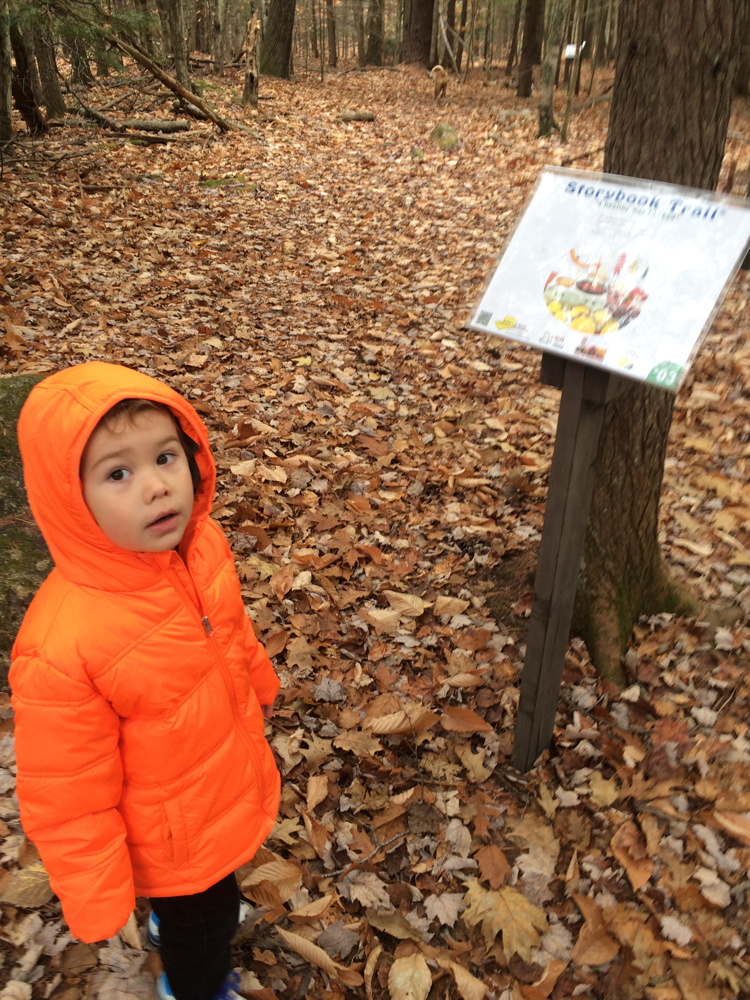
Iron Mountain

I had hiked this trail with my dog Bear maybe 7 years ago. When I arrived at the trail head at 9:45 Trish and the girls were already there. After waking Alex by moving him from his car seat to my back we exchanged greetings and started up the trail. Alex, of course, already had the girls coo’ing over him. He is quite the charmer that kid.

We crossed two open fields and a scenic farmhouse before entering into woods. The trail is a bit eroded in spots, and I imagined it wouldn’t be a fun hike in the rain. It was blue sky however, and the forecast had only mentioned a “slight” chance of isolated afternoon thunderstorms.

The girls relax at the first water break for Max. How did I forget to mention Max!? Max, was their four-legged companion who would prove to be quite the trooper through out the hike.

Great conversation with the girls about their recent hikes and chats with Trish about being a new parent, the politics of internet forums, and the different types of people you come across in the mountains made the steady mile climb to the summit go by pretty fast.

We enjoyed some snacks and water at the official summit marker

Trish had mentioned she wanted to continue along the trail to the scenic “South Ledges” and abandoned Iron Mines mentioned in the guidebooks. The weather still looked agreeable, and the hour early, so I was more than happy to continue. A few minutes off the summit I interrupted the girls chatting with their mother to ask Trish if she had heard something. We both stopped, then identified the roar of a jet passing high above. Relieved, we continued along to the south ledges.

Descending to the South Ledges

After reaching an intersection we took a right and quickly emerged on some large open ledges with excellent views to the west.

Alex & I on the South Ledges- Photo by Sage H

Alex enjoyed some time out of the backpack- Photo by Patricia H.

The view was great here. Earlier an older couple descending from the summit had unfortunately turned around at the summit and remarked on their way down about the lack of  a view. Just 20 minutes downhill from the summit was this excellent vista.

We returned to the junction after a few more snacks and made our way down to the mines. Care needs to be taken here as the trail is a bit nondescript, but small cairns show the way.

We passed a semi-impressive shaft that was filled with muck. I remembered it being filled with water on my last visit and was a bit disappointed to see it didn’t run as deep as my imagination had allowed it to 7 years ago.

We continued downhill past a few “tillings”, or mounds of rock from the excavation process however many years ago. I’ll do some research on this but I’m fairly certain these mines were probably from the 1800’s. Just 2 minutes past the point I had turned around years ago I rounded a corner to find a very cool site. A mine entrance, 10 by 10 feet in dimension, penetrated deep into the mountain.

I set Alex down, who had decided he’d take a nap, and grabbed my headlamp. The floor of the shaft was level, and I could only see about 20 feet into the shaft where a slight right bend beckoned further. I entered, while Trisha did her best to calm her excited girls who were about ready to sprint into the shaft. About 15 feet in I could see what looked like the end of the tunnel, about 40 feet past were I stood. Despite everything looking pretty solid I had a slight feeling of claustrophobia, something I have never experienced in my life. I’d squirmed through tight underwater passages while free diving in Okinawa, but this mine gave me pause. Boy, I would make a terrible spelunker.

The girls joined me and we shined our headlamps as far as the light would go. Patches of rock looked almost silver in the LED light, and I wondered if anyone had recently poked around in here for semi-precious stones.

After scouting around a bit more we decided we had probably found the best mine, but I would come back here in the future to be sure, perhaps by bushwacking up from Jericho Road, which is how I imagined the original miners must have accessed this area. I definitely need to research this place a bit.

As we started climbing back towards the summit a concern started growing in my mind. The humidity was pretty oppressive, and while one forecast had claimed 30% chance of isolated showers, we were approaching 1pm. I had half hoped to be back at the car by 1pm, but hiking with Alex, and new friends, is more social (and leisurely) than hiking alone. We were still a half mile from the summit, which we had to go over again to get back, when we started hearing the “boomers”. We quickened our pace a bit.

I told Trish and the girls about how local updrafts, evidenced by the leaves on the trees turning upside down, was a sure indicator the storm was about to break overhead. I didn’t see that happening yet, but decided to take a quick peak at my Radar Ap on my iPhone. A very small cell was developing  just to our west, over Crawford Notch. On the map it was represented by just a few small pixels of blue and green.

We are about 5 miles east of this

Trish asked how long I thought we had, and I guessed 30 minutes. It was obvious that the radar images were lagging behind what we were seeing as I could see the sky to the north had darkened and gone grey. Going north, up and over the summit, was our only way out. I knew Trish and the girls had been caught in thunderstorms before. I’d been caught a dozen or more times myself, hiking, hanging from cliffs, even once in a snow storm. I knew all about thunderstorm safety and what to do if you find yourself in the mountains during an electrical storm. None of that made me feel any better.

With Alex still asleep I picked up the pace. Trish mentioned if the storm hit us before we reached the summit she wanted to hunker down and let it pass. I agreed, but really hoped it wouldn’t come to that. The summit was less than .2 miles away, and from there it was all down hill back to the cars. I was pouring sweat in the 100% RH, and when a cool breeze hit me in the face I would have welcomed it, had I not known what it meant. Looking at the nearby trees, the leaves were flipping over.

We crossed the summit as the first drops started to fall. Both the radar, and view, indicated we were moving into the storm. This storm was not going to pass us to the north as I had hoped, but was growing wide overhead. Trish mentioned she was fine with me going ahead, and as I picked up my pace on the descent it started raining… hard.

Alex woke up from his quiet slumber to a different scene. Heavy rain was hitting him and Daddy was doing a cautious steady jog down a washed out trail. Not the most comfortable position to wake up in, he started crying.

I did my best to soothe him but I wasn’t about to stop. At my pace I could reach the cars in 20 minutes. I lost sight of the girls behind me, as their mother was wisely slowing them down so they wouldn’t fall on the eroded wet trail and risk injury.

A part of me struggled with going on ahead, as we had started as a group. And while they have way more White Mountain miles under their boots then I do, they were part of my hiking group. However, I had my 10 month old son on my back. I wanted to get him to the safety of the car. I accepted since I would only reach the car 5-10 minutes ahead of them it would be OK.

I reached the open fields 200 yards from the cars. There hadn’t been a flash in a few minutes so I decided to go for it.  As Alex screamed and cried I dashed across the two open fields leading to the parking lot. The car was still hot and muggy so I put Alex in his car seat, started it up for some AC, and hopped in the back with him to try to calm him down. He was giggling at me for hopping in the back seat, and smiling while I dried his hair and face with his blanket. Amazingly what was bothering him just 5 minutes ago seemed like a distant memory.

I looked back towards the trail head for the girls. How far back would they be? If I had someone to stay with Alex I would have already headed back up the trail, but I wasn’t going to leave him alone, even in the safety of the car. 3 minutes later Alex H appeared and ran over to tag the trunk of her mom’s car. Sage and Trish were seconds behind. I jumped in the front seat and yelled to Trish to meet with me back in town so we could say our farewells outside of the storm.

We drove down the dirt access road in what appeared to be a monsoon. When I reached Rt 16 I checked the radar again on my phone.

The Red Center is where we were 10 minutes ago. We headed south on 16 and pulled off in Glen, just on the edge of the storm cell. In the parking lot of Glen Juntion we shook hands, and checked out a small abrasion Sage had gotten on her leg during the descent. Earlier in the hike when Sage got a small scrape her mom said tongue-in-cheek “It’s not a real hike unless there’s blood or mud”. Well, we certainly could call this a real hike. We had a little bit of blood, a whole lotta mud, and a fair bit of thunder and lightning to go around.

I was happy to experience Alex’s 1st hiking storm in the company of such brave girls, and the cool-headedness of Trish. I wonder if Alex will have any memory of this hike. I know I’ll never forget it.

Read Full Post »

I know I promised the “What Not To Do” article but today was too nice a day to not share it right away. “What Not To Do” is still a work in progress and will post soon.

My amazing niece, Sarah is visiting from Amherst, NH. She was keen on hiking with me, and Papa was game for a short hike as well. I was itching to do a little technical climbing so late last night I decided Square Ledge in Pinkham Notch would be a good destination.

Square Ledge, Lost Pond, and Glen Ellis Falls

I’ve been to Square Ledge close to 50 times, but this was the first for Alex, Papa, and Sarah. A short 25 minute hike with an excellent view, this is a very heavily traveled trail. It climbs about 400 feet in a half mile.

Square Ledge is that cliff behind Sarah and Papa

We crossed the road, then the Ellis River over a footbridge, and started the moderate climb up to the ledge. Papa realized he hasn’t hiked in 18 years and Sarah commented this would be good training for Ice Hockey (she’ll be a High school Sophomore in the Fall). Alex coo’d and ah’d as he usually does.

We passed some families and camp groups learning the basics of rock climbing from local climbing guides before we reached the scenic top.

Stunning view of the east side of Mount Washington

Alex got some time out of the pack, stretching and eating in the light breeze. He downed an 8 ounce bottle of formula and we packed it up after one more summit photo.

Alex was loving it

As we headed back down I was itching to climb something a bit technical and asked the climbers who had a rope set-up on “The Chimney” if they would mind if I took a quick run on it. No one was climbing it, and they obliged. Sarah and Papa stayed with Alex while I took a quick romp up the very familiar climb sans rope. Two minutes later Alex was back on my back and we headed down the trail bidding farewell to some “inquisitive” visitors at the top.

The weather was so excellent I didn’t want the hike to end so on the descent I brewed a plan. I’d never hiked along Lost Pond to Glen Ellis Falls, so I thought this would be a great time to do so. Papa could grab the car at Pinkham and meet us a mile down the road for the .3 mile walk to Glen Ellis Falls. Sarah and I could take the 1 mile Lost Pond Trail to get to Glen Ellis Falls. I shared the idea and it was accepted.

Lost Pond Trail

I’d gone a few hundred yards down this trail in search of an ice climb a few years before and was impressed with how nice it was. Another classic example of how a bit of solitude can be found right next to one of the busiest trails. In between admiring beaver dams we chatted about Highschool, Facebook, and whatever else came to mind.

Lost Pond

Alex had fallen asleep before we reached the Lost Pond Trail, and slept soundly the whole mile to Ellis Falls Trail. 20 minutes after leaving Papa back at the Square Ledge trail we linked up with him and  headed down to the falls. The stone steps and trail work on this short .3 mile section of trail is quite impressive. It definitely allows the “flip’flop” crowd relatively easy access to a beautiful location!

Top of Glen Ellis Falls

We headed down to the bottom of the 64 foot tall falls and watched as some brave 20 somethings jumped from various heights in to the pool at the base of the falls before returning to the car.

Bottom of Glen Ellis Falls

A perfect couple of hours out with a niece I don’t get to see enough. This combination of trails is a perfect kid hike, though there is a river crossing at end, and the issue of moving a car or re-hiking the Lost Pond Trail (only a mile). Speaking of river crossings, that’s a big part of the “What Not To Do” article coming very soon, so please stay tuned!

Read Full Post »

Older Posts »

%d bloggers like this: